Skip to content

How UWB Technology Can Help You Realize the Forklift Geofencing Function
Painted lines and physical barriers only slow a forklift down if the driver notices them. UWB-based geofencing creates invisible, software-defined boundaries that a forklift's own safety system can see and react to automatically — here's exactly how the technology makes it work.

UWB anchors track forklift position in real time, letting warehouses draw virtual zone boundaries instead of relying on paint and physical barriers.
Most warehouses already try to control where forklifts go — floor tape, mirrors, speed bumps, painted pedestrian lanes. The problem is that every one of those controls depends on a driver noticing them and choosing to slow down. Forklift geofencing flips that dependency. Instead of a boundary the driver has to see, it's a boundary the truck itself can see — and act on, whether the operator is paying attention or not.
UWB (Ultra-Wideband) is the technology that makes this practical indoors, where GPS doesn't reliably work and standard RFID can't tell you much more than "something is nearby." This guide walks through exactly what forklift geofencing is, how UWB positioning makes it possible, and what a working geofenced zone actually does inside a live warehouse.
1. What Is Forklift Geofencing?
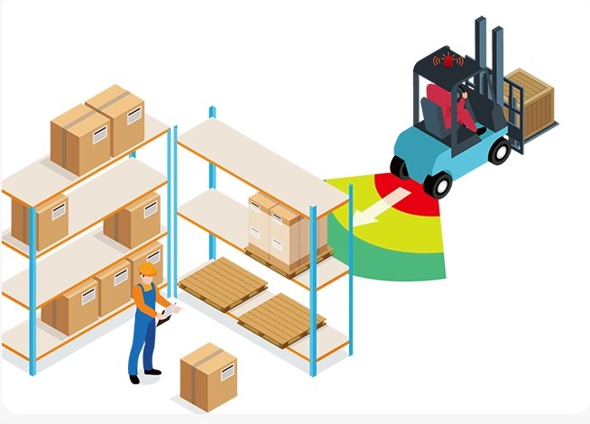
Forklift geofencing is the use of virtual, software-defined boundaries drawn over a warehouse or yard map. Instead of a physical fence or gate, the "fence" exists as coordinates in a positioning system. When a forklift's tracked position crosses that boundary, a rule fires automatically — the truck slows down, an alert sounds, access is denied, or a supervisor gets a notification.
The concept isn't new — fleet vehicles and delivery trucks have used GPS geofencing outdoors for years. The challenge has always been making it work indoors, where GPS signal is unreliable or absent entirely. That's the specific gap UWB positioning closes.
2. Why UWB Is the Technology Behind Modern Geofencing
UWB (Ultra-Wideband) is a short-range radio technology that measures distance by timing how long a radio pulse takes to travel between two points, rather than measuring signal strength like WiFi or Bluetooth. Because it's measuring actual travel time, UWB positioning is typically accurate to within roughly 10-30 centimeters — precise enough to reliably tell whether a forklift is one meter inside a restricted zone or one meter outside it.
That level of precision is what separates a real geofence from a rough approximation. A boundary that's only accurate to a few meters either triggers constantly in the wrong place or misses real crossings — neither is usable for automatic speed control near a pedestrian walkway or a narrow rack aisle.
3. How UWB Actually Creates a Virtual Zone
A UWB geofencing setup has three working parts:
- Fixed anchors — small UWB receiver units mounted around the facility (on racking, columns, or ceilings) at surveyed, known positions.
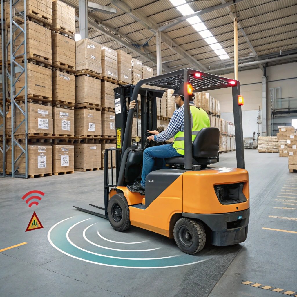
- A forklift-mounted tag — a UWB unit on the truck that exchanges radio pulses with the surrounding anchors.
- Positioning and zone software — the system that triangulates the tag's real-time position from anchor readings, and checks that position against zones you've drawn on the facility map.
Setting up a zone is a software task, not a construction project: an administrator draws a boundary on the digital floor plan — around a pedestrian lane, a narrow aisle, a racking area, or a dock door — and assigns a rule to it. From that point on, every time a tagged forklift's calculated position crosses that line, the assigned rule fires automatically, in real time, with no physical sensor sitting at the boundary itself.
📡 What the anchors do
- Stay fixed at known, surveyed positions
- Continuously exchange radio pulses with tags
- Feed raw distance data to the positioning engine
- No moving parts, minimal maintenance
🖥️ What the software does
- Triangulates real-time tag position (~10-30 cm accuracy)
- Checks position against every drawn zone
- Fires the assigned rule on a boundary crossing
- Lets you add or resize zones without new hardware
4. Geofencing Functions UWB Makes Possible
Once virtual zones exist, they can drive several distinct safety and operational functions — most facilities layer more than one:
- Automatic speed reduction: A forklift entering a pedestrian-heavy zone or a narrow aisle is automatically capped to a lower speed, independent of what the driver chooses to do.
- Restricted-area alerts: Entering an unauthorized zone — a racking area rated for a different load class, a fragile-inventory section, or a contractor-only space — triggers an immediate cab alert.
- Automatic slow-down or stop: When paired with the truck's controller through a forklift automatic braking system, a zone crossing can trigger a controlled slow-down or full stop rather than only an alert the driver has to act on.
- Dock and charging-zone access control: Zones around dock doors or charging stations can restrict entry to authorized trucks or flag unscheduled entries.
- Time-based or shift-based zones: Some zones only need to be active during specific hours — for example, a loading bay that's pedestrian-heavy only during shift changes.
- Zone-entry logging: Every boundary crossing can be time-stamped and logged, giving safety managers a record of near-miss patterns by zone rather than relying on incident reports alone.
See the tag hardware that makes this work
Every geofencing function above depends on the same forklift-mounted UWB tag and anchor network used for proximity warning.
Explore the UWB Tag-Based Forklift System →5. UWB vs GPS vs RFID for Geofencing
UWB isn't the only positioning technology that gets used for geofencing — GPS and RFID both show up in warehouse conversations. The difference is what each one can actually deliver indoors.
| Factor | UWB | GPS | Standard RFID |
|---|---|---|---|
| Indoor reliability | ✓ Strong, purpose-built for indoors | ✕ Weak/unavailable indoors | Moderate, read-range dependent |
| Positioning accuracy | ~10-30 cm | 2-5 m (outdoors, best case) | Proximity only, not true position |
| Zone boundary precision | ✓ Tight, reliable boundary | ✕ Too coarse for tight indoor zones | ✕ Approximate at best |
| Update rate | Real-time, continuous | Real-time (when signal available) | Read-point dependent, not continuous |
| Works around racking/obstructions | ✓ Yes, non-line-of-sight | ✕ No, needs sky view | Limited by reader range |
| Typical best fit | Indoor forklift geofencing & proximity | Outdoor yard & over-the-road fleet | Asset tracking, access badges |
6. Three Zones Worth Geofencing First
Pedestrian Crossing Lanes
Marked walkways that intersect forklift traffic are a natural first zone. A geofenced boundary automatically caps forklift speed the moment the truck enters the crossing, regardless of whether the driver remembers the painted line is there.
Narrow Rack Aisles
Tight aisles between racking are a common site for both forklift-to-forklift and forklift-to-pedestrian near misses. A geofenced aisle zone can enforce a lower speed limit the entire length of the aisle, working alongside proximity warning between trucks sharing that space.
Dock Doors and Staging Areas
Dock approaches see mixed traffic — trucks, forklifts, and pedestrian staff — often with reduced visibility from parked trailers. A geofenced dock zone can trigger both a speed reduction and a cab alert, adding a layer beyond what a fixed camera system covers on its own.
7. What Geofencing Actually Prevents
Painted lines and posted speed limits rely entirely on driver compliance. A geofenced zone removes that dependency for the specific behaviors that cause the most serious incidents: excess speed in pedestrian areas, entry into restricted or hazardous zones, and unmonitored access to dock doors or charging areas. Because zone crossings are logged automatically, safety managers also get a data trail — which zones get crossed at speed most often — instead of relying on near-miss self-reporting, which tends to undercount real risk.
Not Sure Which Zones to Geofence First?
We help warehouse and fleet managers map actual near-miss patterns and design a UWB geofencing layout matched to those exact zones.
Get a Free Fleet Safety Assessment8. What a UWB Geofencing Rollout Looks Like
A typical rollout follows a similar sequence regardless of facility size:
- Facility survey: Anchor placement is planned against the building layout to give full coverage of the zones you intend to geofence.
- Anchor installation: Fixed anchors are mounted at surveyed points — racking, columns, or ceiling mounts — with no cabling changes to the trucks themselves.
- Tag installation: A UWB tag is fitted to each forklift, and integrated with the truck's controller if automatic speed reduction or braking is part of the plan.
- Zone mapping: Boundaries are drawn on the digital floor plan and assigned rules — alert only, speed cap, or full restriction.
- Testing and tuning: Zone thresholds are checked against real truck movement and adjusted before going live fleet-wide.
Because zones live in software, expanding coverage later — adding a new restricted area, tightening an aisle boundary, or retiring a zone that's no longer needed — doesn't require new hardware at the boundary, only an update to the existing anchor network's zone map.
Building a layered indoor safety system?
Geofencing pairs naturally with tag-to-tag proximity warning and AI camera coverage for a complete setup.
Read: AI Camera vs UWB — Which Prevents More Accidents? →9. Frequently Asked Questions
Tap a question to expand the answer.
What is forklift geofencing?
How does UWB technology enable geofencing?
Is UWB more accurate than GPS or RFID for geofencing?
Do geofencing zones require physical sensors at every boundary?
Can UWB geofencing automatically slow down or stop a forklift?
What warehouse areas benefit most from UWB geofencing zones?
Ready to Turn Your Floor Plan Into a Safety System?
Tell us about your facility layout and we'll map out where UWB geofencing zones would do the most good — no over-buying, no guesswork.
Talk to a Forklift Safety Specialist